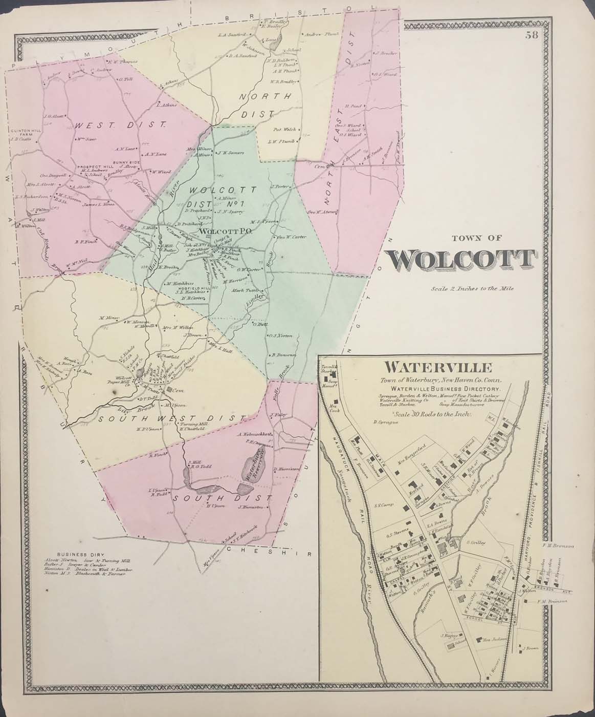
Map of the Wolcott, Connecticut from FW Beers Atlas of New Haven County 1868. 16″x13.5″. Map is hand colored. Railroads, streets, property owners,and rivers are listed. There is a small map of Waterville and a business directory. There is one small piece of tape on the back that is outside the frame of the map. (224)