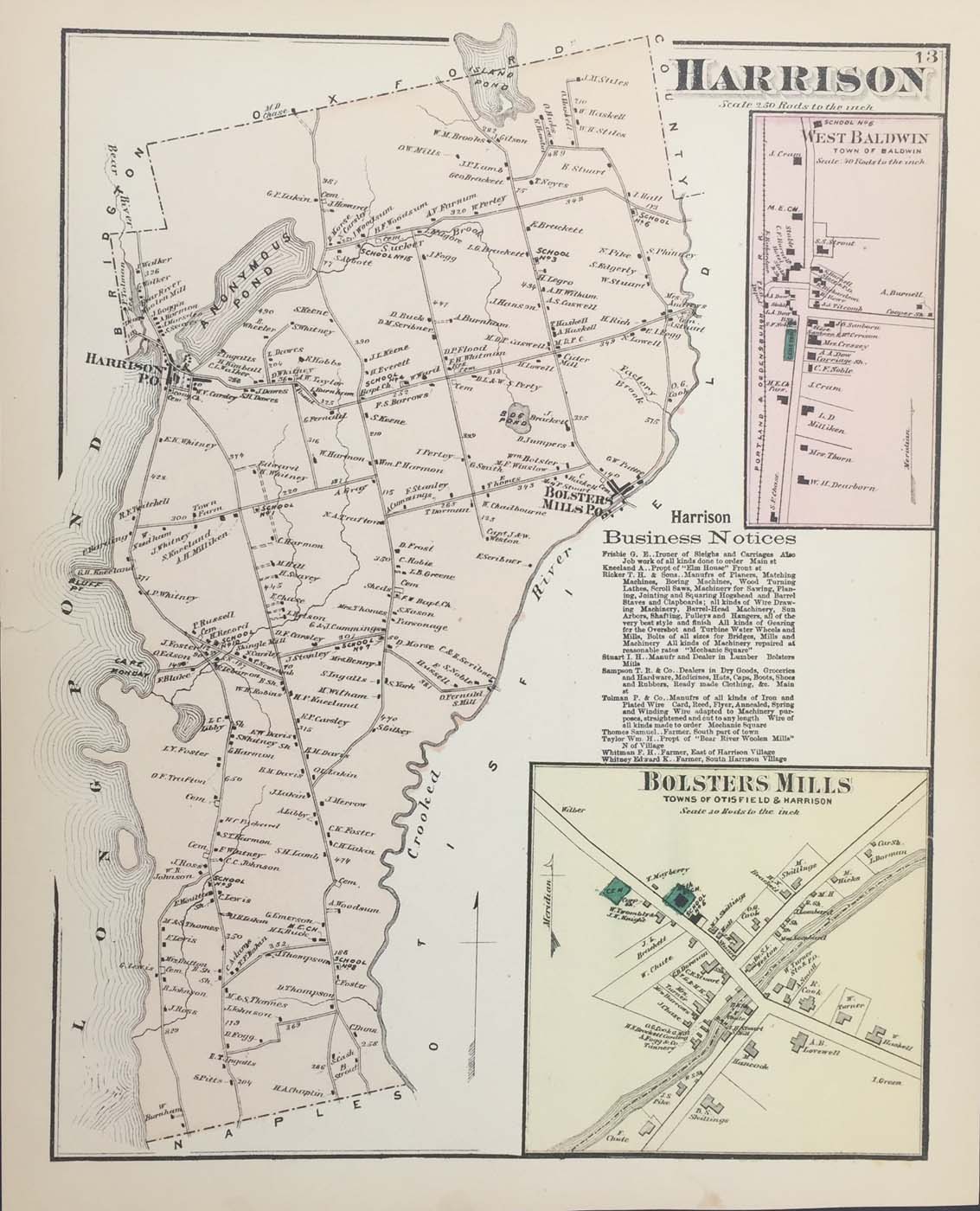
Map of Harrison, Maine from FW Beers Atlas of Cumberland County Maine 1871. 14.5″x12″ Map is hand colored. Railroads, rivers, streets, and property owners are listed. There is a business directory and two small maps of Bolsters Mills and West Baldwin. (115)