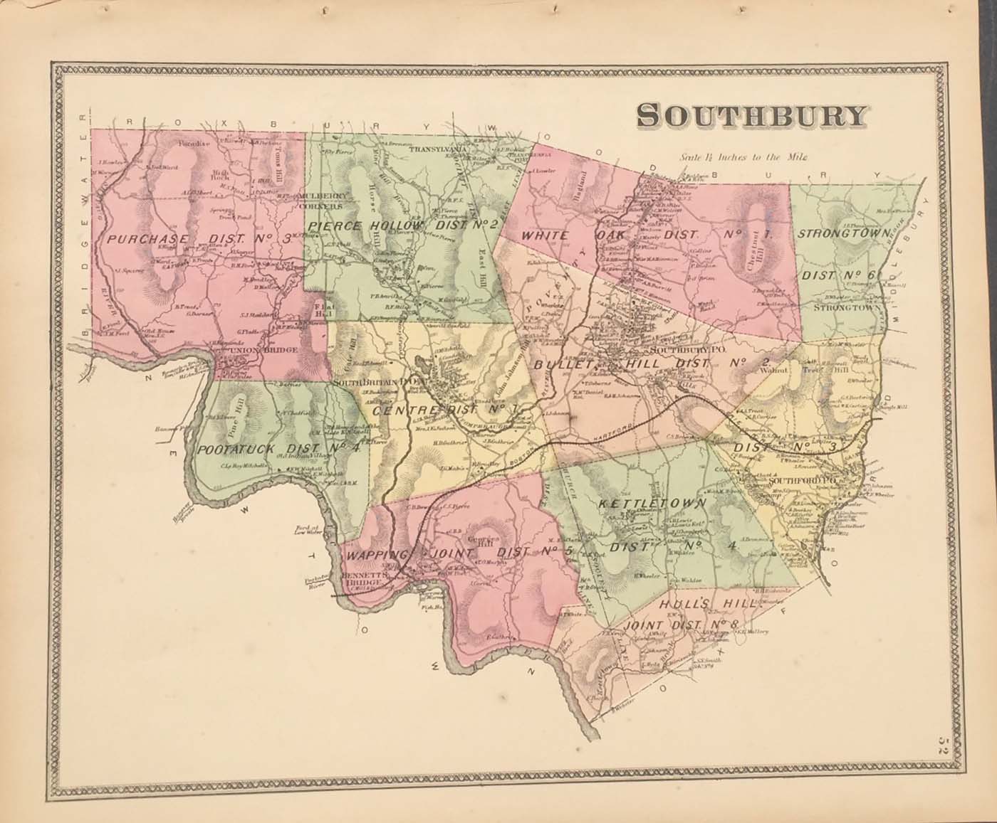
Map of Southbury, Connecticut from the FW Beers Atlas of New Haven County 1868. 16″x14″ Map is hand colored. Railroads, rivers, streets, and property owners are listed. (104)
Map of Southbury, Connecticut from the FW Beers Atlas of New Haven County 1868. 16″x14″ Map is hand colored. Railroads, rivers, streets, and property owners are listed. (104)