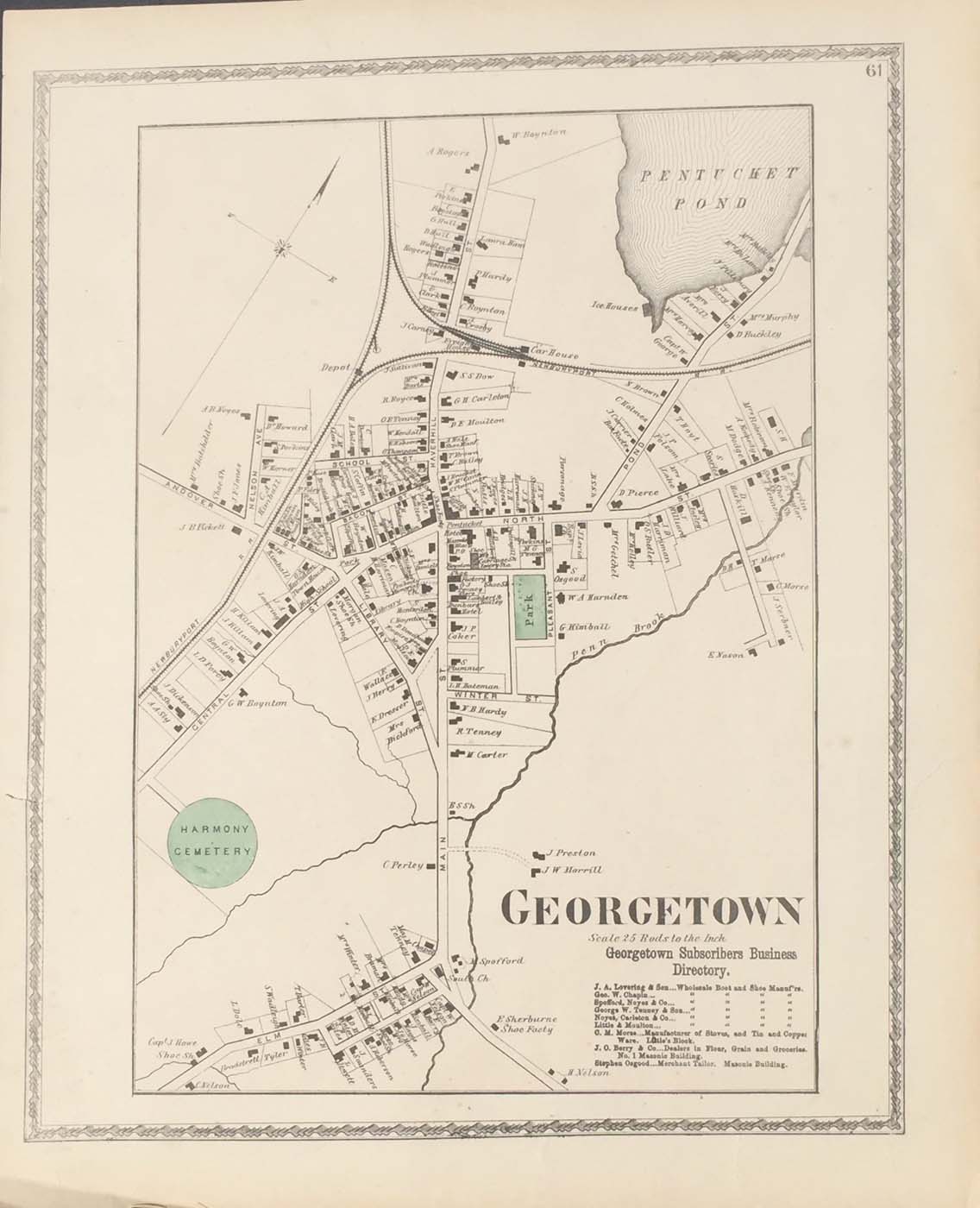
Map of Georgetown, Masachusetts downtown from FW Beers Atlas of Essex County 1872. 16.5″x13.5″ Map is hand colored. Railroads, rivers, streets, and house owners are listed. There is a business directory in the bottom right corner of the map. (86)
Map of Georgetown, Masachusetts downtown from FW Beers Atlas of Essex County 1872. 16.5″x13.5″ Map is hand colored. Railroads, rivers, streets, and house owners are listed. There is a business directory in the bottom right corner of the map. (86)