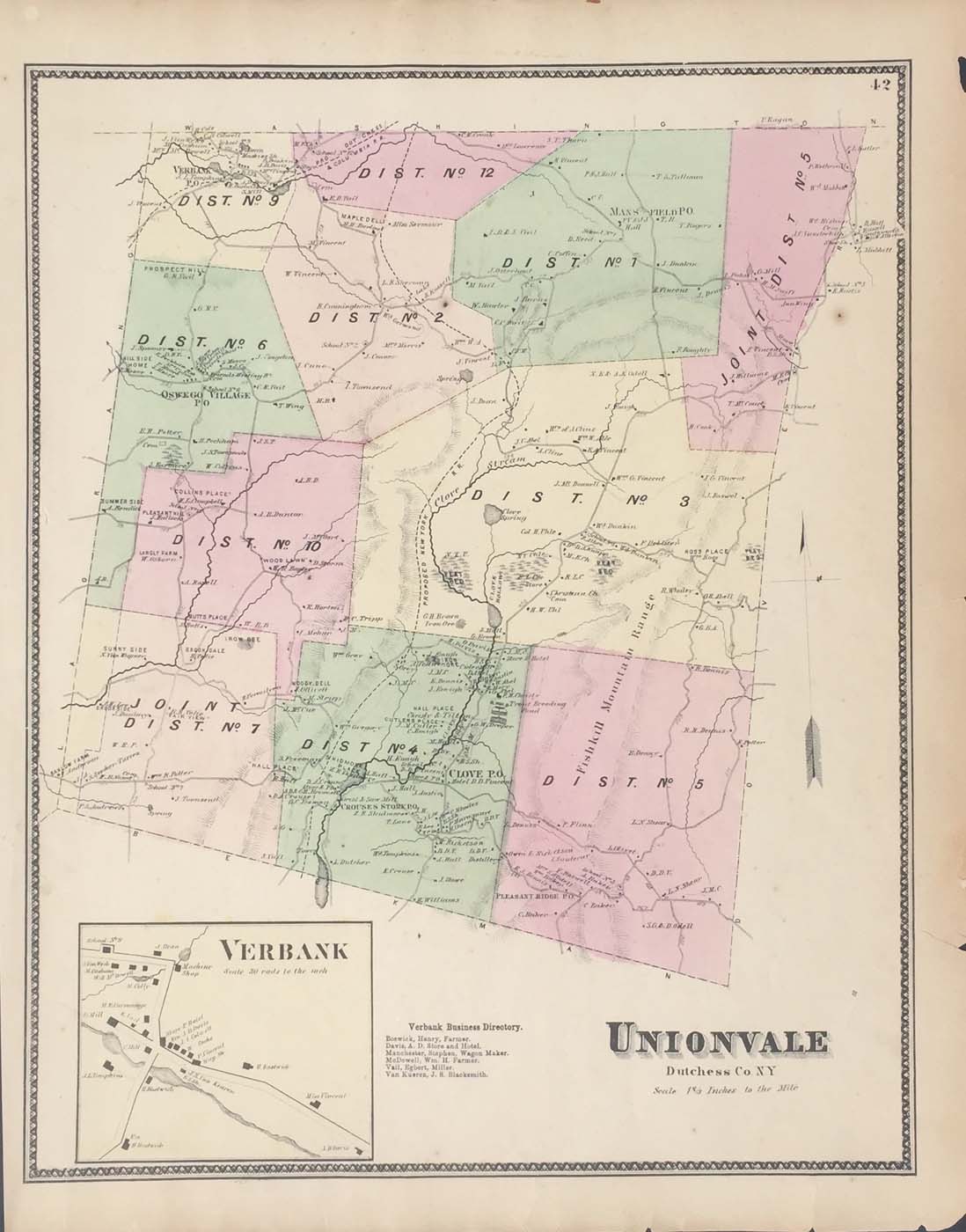
Map of Unionvale, New York from FW Beers Atlas of New York and Vicinity 1867. 14.5″x18″. Map is hand colored. Railroads, rivers, streets, and property owners are listed. There is a business directory and a small map of Verbank. (150)
Map of Unionvale, New York from FW Beers Atlas of New York and Vicinity 1867. 14.5″x18″. Map is hand colored. Railroads, rivers, streets, and property owners are listed. There is a business directory and a small map of Verbank. (150)