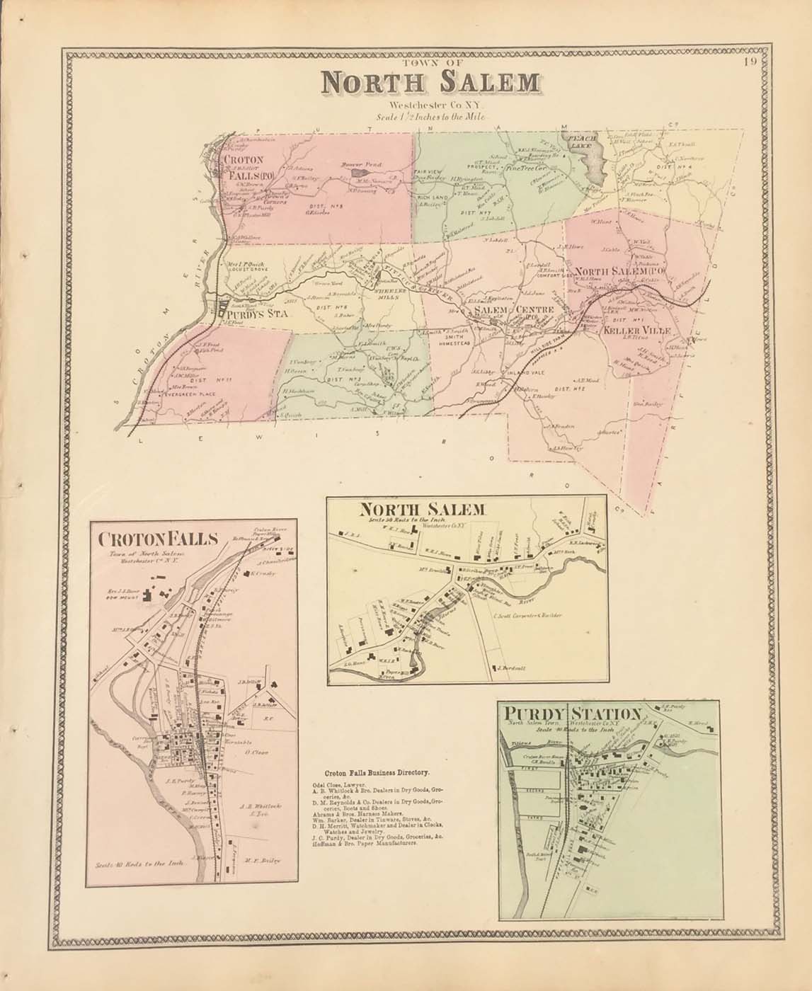
Map of North Salem, New York from FW Beers Atlas of New York and Vicinity 1867. 17.5″x14.5″ Map is hand colored. Railroads, rivers, streets, and property owners are listed. There are three small maps of Croton Falls, North Salem, and Purdy Station.(93)